
GPSOutdoor positioning
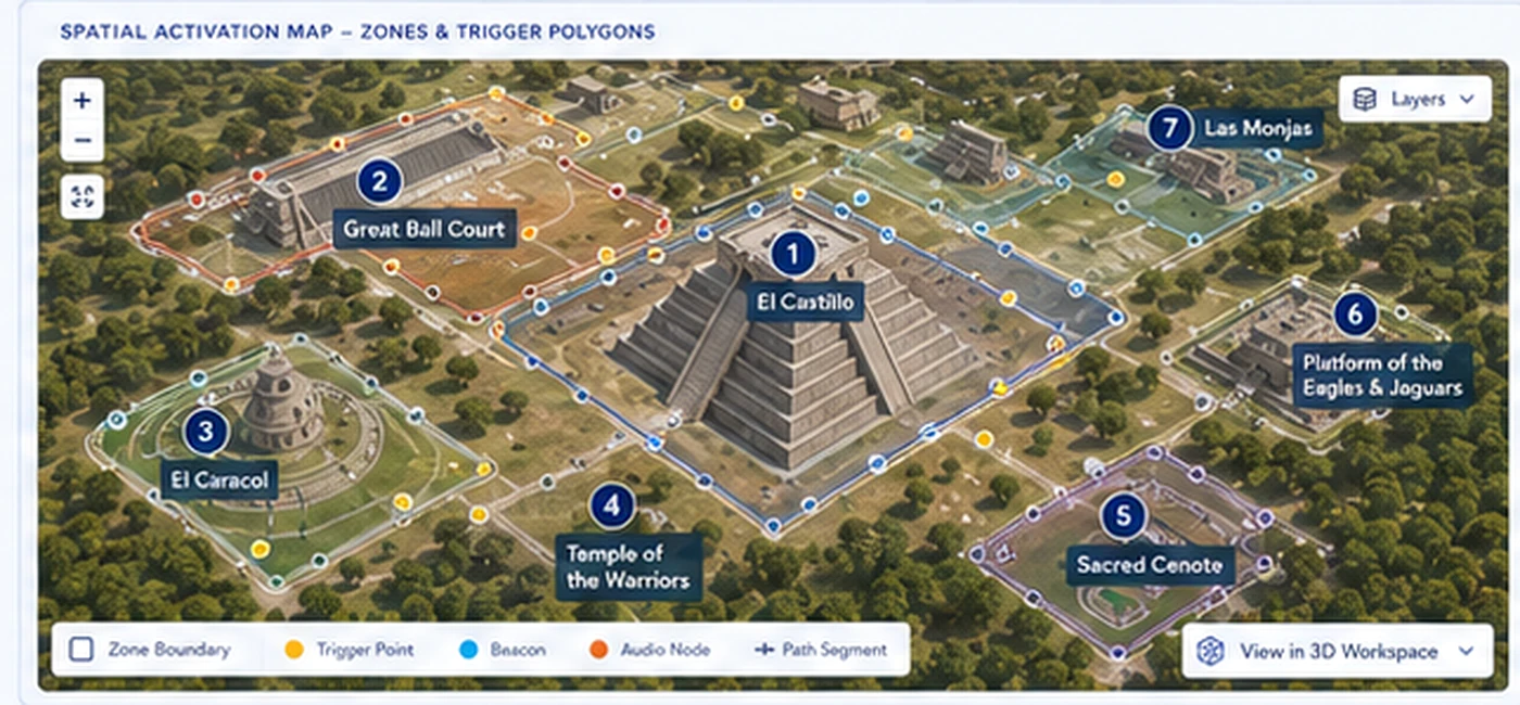
Spatial activation
The right story, in the right place, at the right time.
Multi-layer spatial intelligence uses GPS, site mapping, visual landmarks, local beacons, dwell logic, and proximity audio to place interpretation within the visitor’s physical experience.
LandmarksVisual registration
BeaconsLocal signal support
ProximityAudio scales with approach
Platform architecture
Purpose-built modules, one controlled deployment system.
Hardware, spatial delivery, content governance, operations, and institutional review share one connected architecture without flattening local site requirements.
01
Authorized Zones
Experiences activate only within configured site boundaries.
Explore module →02Trigger Logic
Entry, dwell, route, and proximity rules coordinate content.
Explore module →03Offline Delivery
Site packages remain available under limited connectivity.
Explore module →04Field Validation
Each site requires local performance and overlap testing.
Explore module →Applied research connection
Research, engineering, and field evidence improve one another.
Stella Nova develops models, content, field validation, and operating research. HeritageView engineers, validates, deploys, and measures. Heritage Core preserves the canonical record between them.
Stella NovaResearch & validation→Heritage CoreCanonical records→HeritageViewEngineering & operations